
Council Bluffs Neighbors by Source
A block lookup starts with an address and asks what each official system can prove. County GIS defines the parcel relationship. The Assessor adds owner, mailing, situs, sales, and building fields. City address data helps resolve units and whether an address lies inside Council Bluffs. Community layers add place context, not a private roster.
| Source | What it shows about a block | Access |
|---|---|---|
| County GIS viewer | Adjacent parcel shapes, roads, zoning, districts, flood and ZIP layers | Free map; not a legal survey |
| Assessor cards | Owner, mailing and situs addresses, sales and buildings | Free individual search |
| City address points | Parsed address, parcel ID, postal code, zoning, flood and InCity status | Free public GIS layer |
| Voter records | Registration data under restricted request rules | Known-person lookup or lawful list request |
| Neighborhood layer | Association boundaries and public contact fields | Public schema; no member list |
| Old directories | Year-specific past occupants and businesses | Library or genealogy collection |
An owner's mailing address can differ from the parcel's permanent or situs address. That difference is routine and must not be used to claim vacancy or occupancy. A deed, assessment, or permit records a legal or administrative event, not all Council Bluffs neighbors in a household.
Map Council Bluffs Neighbor Parcels
The Pottawattamie County viewer supports Find and Identify tools, parcel reports, linked maps, buffers, measurements, printing, and historical layers. Start with one precise address or parcel identification number, called a PIN. Keep the subject parcel separate from lots that touch its front, rear, or side.
- Find the subject address or PIN and turn on parcels, address points, streets, municipal boundary, ZIP, zoning, flood, and neighborhood layers.
- Click or buffer nearby parcels. Record each PIN, situs address, legal description, and its map relation to the first lot.
- Open the Assessor card for each parcel and compare owner, tax mailing address, sales, building, and map fields.
- Stop at what the record proves. Do not infer unnamed occupants or publish a theory about who is inside a home.
A parcel report can download selected information, but the county warns that mapped lines are not a legal survey. For a full named-street chain, use the Council Bluffs street directory workflow rather than expanding a block search without limit.
Council Bluffs Neighbor Field Guide
The county parcel REST layer exposes fields that make a block search repeatable. PIN identifies the parcel. OWNER is the assessed owner. ADDRESS is the property or situs location, while TaxAddress is used for tax mail. LEGAL stores the legal description. DEED, BOOK, and PAGE can point toward a recorded instrument. Acreage and value fields describe the parcel, not a person.
- PIN
- The parcel identification number used to keep a lot stable across searches.
- Situs address
- The permanent address assigned to the property itself.
- Tax address
- The destination for assessment or tax mail, which may be elsewhere.
- Legal description
- The lot, block, subdivision, or land description used in property records.
The 400 Willow Avenue library property card illustrates the distinction: its permanent address and its tax mailing address are different fields. That is a useful Council Bluffs records lesson, not evidence about where a person sleeps.
Council Bluffs Address Points
The city EPL address-point service breaks an address into house number, direction, street name, suffix, unit, postal code, and parcel link. It also exposes an InCity value, zoning and flood fields, and maintenance timestamps. Preserve the raw FullAddress beside its parsed pieces. A unit or directional suffix can separate neighboring records that look alike in plain text.
InCity helps resolve a local postal quirk. A Council Bluffs mailing line, especially in ZIP 51503, does not by itself prove that a parcel sits within the municipal boundary. Compare the city field with the county municipal layer and Assessor card before assigning a block to city jurisdiction.
Council Bluffs Neighborhood Contacts
The county GIS neighborhood-association layer provides polygons and a public schema for association name and type, two contacts, phone and email fields, meeting notes, website, mailing address, and geometry. The unattended research did not expose a reliable current list of association names. Use a live layer query for current contacts and never invent a roster.
Inspect the official neighborhood association layer before using the captured schema below.
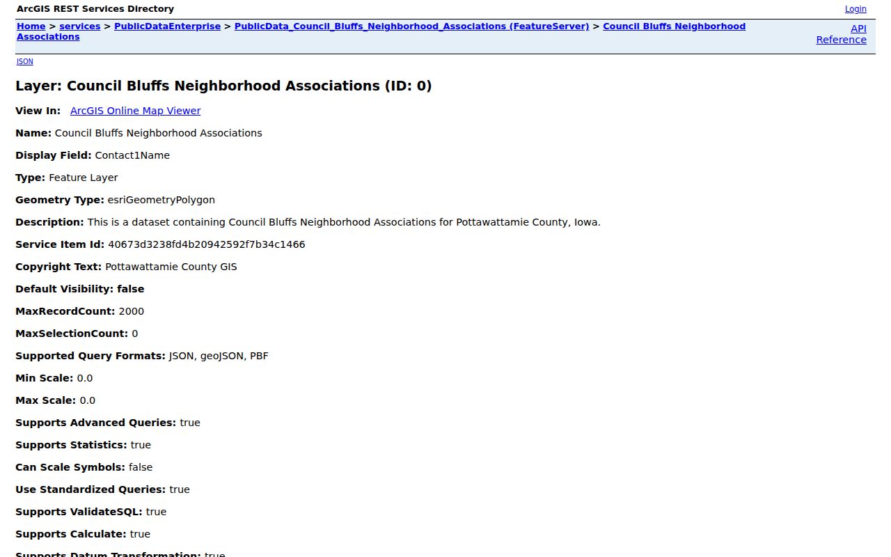
The image confirms that Council Bluffs publishes association boundaries and contact fields. It does not show a member directory or identify every neighbor inside a polygon.
Planning and Zoning
Council Bluffs Planning and Zoning
Community Development: (712) 890-5350
Plans, subdivisions, zoning and historic preservation
Neighborhood Watch
Council Bluffs Neighborhood Watch
Community communication and positive neighborhood groups
No public member list located
Council Bluffs Block Context
The official subarea plan identifies four useful place frames. West Broadway reaches from the I-29 interchange toward the Mid-City rail corridor and includes nearby avenues. Kanesville-Tinley has irregular residential blocks plus industrial and traffic effects. South Main includes adaptive reuse and older industrial land. The I-80 and Highway 6 area covers the freeway interchange and Iowa Western growth context.
The current Council Bluffs 2050 planning work gathers public input on land use, mobility, infrastructure, historic preservation, neighborhoods, and public spaces. These planning areas explain a block's civic setting. They are not lists of Council Bluffs neighbors.
Council Bluffs Neighbors and Voter Data
The public individual voter form requires a known first name, last name, and ZIP. It cannot be used to browse every person on a block. A formal list request is separate. Iowa Code section 48A.34 permits inspection at reasonable times, while section 48A.39 limits uses and prohibits commercial use. The Secretary of State form requires requester details, a permitted purpose, jurisdiction, participation and party choices, status, delivery format, payment, and signature.
Even a lawful voter list does not reveal how anyone voted. It also excludes Social Security numbers, voter identification numbers, driver's license numbers, and state ID numbers. Safe at Home voter information receives special protection. Treat registration as dated election data, not proof of who occupies a dwelling today.
Official Council Bluffs Neighbor Records
Commercial neighbor tools often merge stale profiles, phone data, guessed relatives, and copied public records. An official source is narrower but makes its keeper, date, fields, and limits easier to check. That difference matters when two names or addresses are similar.
| Question | Official record | Commercial category |
|---|---|---|
| Who owns this parcel? | Assessor card and Recorder deed | May copy or lag behind the roll |
| Which lots touch? | County GIS, with survey warning | Map source may be unclear |
| Who lives here now? | No single complete official roster | May infer occupants without proof |
| How can a result be fixed? | Contact the named custodian | Use the provider's privacy route |
For property questions, retain the PIN and source date. For a copied private profile, save its URL and use that provider's deletion or correction process. Removing a profile does not amend a county record.
Historical Council Bluffs Neighbors
The Council Bluffs Public Library holds city directories beginning in 1866, local maps, yearbooks, newspapers, census and cemetery resources, microfilm, and obituary help. A reverse or criss-cross directory groups entries by address, making it useful for a dated block. The Pottawattamie County Genealogical Society reports directories through 1994 with some later runs, plus phone books and maps.
Library of Congress Sanborn sets from 1885 and 1896 show buildings, uses, streets, and block shapes. Pair one dated map with a directory year and a deed or legal description. A footprint does not name its occupant, and an old directory entry does not identify today's neighbors.
Privacy for Council Bluffs Neighbors
Parcel, tax, planning, and permit records omit many people by design. Utility, delivery, and private association membership data are not public block directories. Iowa Safe at Home protects qualifying survivors through a substitute address, confidential voter registration, mail forwarding, and limits on disclosure under Chapter 9E. Never attempt to reverse a substitute address.
Neighborhood Watch groups are for communication and civic care. The city states that participants do not patrol or make arrests. Use the city's official reporting routes for a real issue, and use emergency services when immediate harm is present.
Lawful use. Learn about Council Bluffs neighbors with care. Do not use public records for surveillance, repeated unwanted contact, stalking, harassment, intimidation, or harm.