
Search Council Bluffs Streets
An address search works best as a chain, not as a single result. The Pottawattamie County Assessor links a Council Bluffs address to a parcel identification number, current tax owner, situs address, mailing address, sales lines, and a map. Those facts establish tax and parcel evidence, not a list of everyone inside the building. Follow the same parcel into county GIS, then use its legal description, deed, book, and page keys in Recorder sources. A street directory result becomes stronger when several dated records agree.
- Enter a short street fragment and Council Bluffs in the assessor form. Save every returned PIN and legal description.
- Open each card’s map, then inspect side, rear, vacant, and multi-unit parcels in the county GIS viewer.
- Confirm a known person through Iowa’s name-and-ZIP voter lookup. It does not permit an open browse of everyone on a street.
- Carry the owner name, legal description, book, and page into the Recorder’s modern and historical deed indexes.
- For a dated occupant question, consult the library or PCGS street and criss-cross directory runs.
Preserve dates at every step. A tax card can change after a transfer, an address layer can be edited, and a printed directory reflects its publication year. Missing directory years do not prove a move. When the goal shifts to one old address rather than an entire named road, the Council Bluffs previous residents trail gives the backward method.
Council Bluffs Address Search Fields
The assessor form supports several ways into the same street directory. Start broad, because a direction or suffix entered differently can hide a useful result. The Map checkbox is selected by default. Once a card opens, distinguish the permanent or situs address from the tax mailing address and retain the PIN in both its displayed and plain-number forms.
| Search control | How to use it | Result value |
|---|---|---|
| Owner last / first | Use when a property holder is known | Find parcels tied to that tax name |
| Street | Enter a short street fragment first | Browse matching Council Bluffs cards |
| Town or ZIP | Narrow with Council Bluffs or a local ZIP | Filter without proving city limits |
| Parcel number | Use the exact PIN from GIS or a card | Reach one parcel directly |
| Map | Leave checked for spatial context | Move to nearby parcel views |
The card can show owner, tax description, values, exemptions or credits, sales history, building details, sketches, photographs, and historical as-of options. Online assessor information begins in 1997 according to the portal, so earlier ownership calls for Recorder, Auditor, archive, or office research.
One Council Bluffs Address, Two Roles
The City Library parcel at 400 Willow Avenue is a useful local field lesson. Its assessor example separates the permanent or situs location at 400 Willow from a mailing address at 209 Pearl Street. The owner’s correspondence address is not proof of where a household lives. Store the two fields separately before comparing any street directory entries.
The county parcel schema shows how much more sits behind a mapped shape. PIN, owner, tax address, subdivision, block, lot, legal description, deed date, book, page, values, acreage, and district fields can all help distinguish similar street numbers.
The official parcel field schema can be inspected in this Council Bluffs street directory capture.
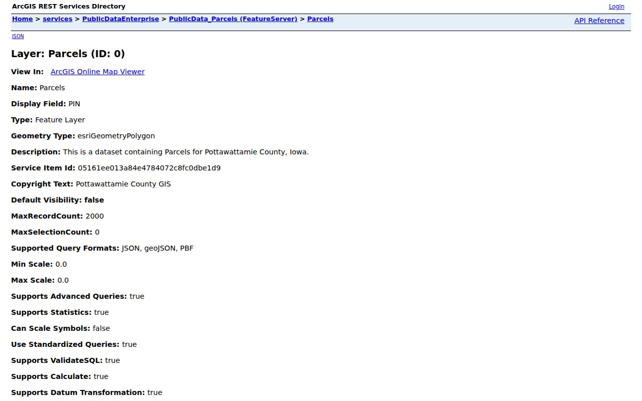
The schema supports a careful join by PIN and legal description, instead of a guess based on the street label alone.
Council Bluffs Street Address Points
The Council Bluffs public address layer normalizes street records before comparison. It contains a full address, component lines, direction, street type, unit or suite, postal code, parcel link, zoning, flood context, maintenance dates, and an InCity Y/N flag. This is especially useful when the postal last line says Council Bluffs but the parcel may sit beyond the municipal boundary.
The address-point service appears in the image below with its public field and query details.
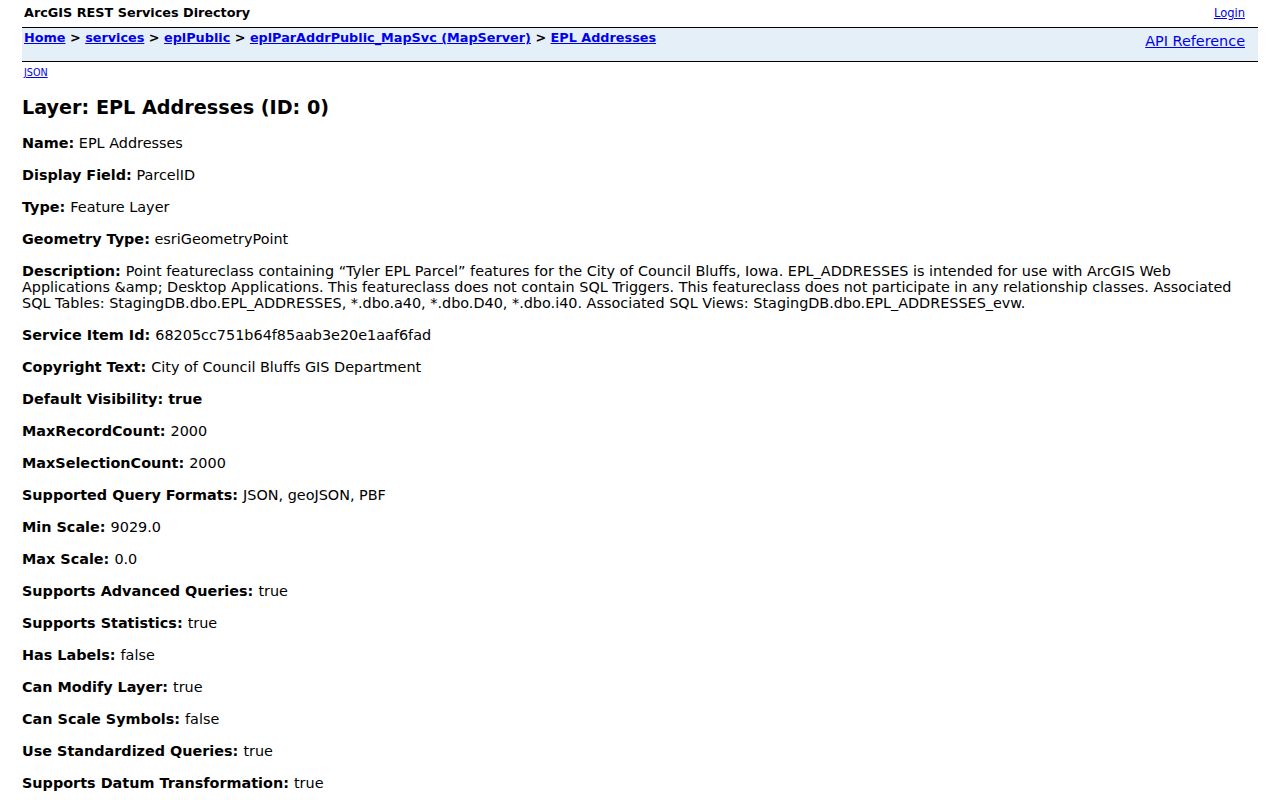
Join the address record to the county parcel through its parcel key, then verify current boundaries. A GIS flag is strong geographic evidence, but it is not a legal survey.
Council Bluffs Street Record Coverage
No one source is a complete Council Bluffs street directory. County property systems identify parcels and owners, city reports record dated work, and historical directories may list occupants for a publication year. The useful question is what each keeper actually certifies.
| Record Set | Keeper | What It Shows | Access |
|---|---|---|---|
| Assessor card | County Assessor | Tax owner, situs/mailing fields, PIN, sales | Free online card; office help |
| GIS parcel map | County GIS | Shapes, adjacent parcels, zoning, districts | Free viewer and public layers |
| Deeds and liens | County Recorder | Recorded parties and instrument trail | AVA, scanned indexes, office originals |
| Voter record | Iowa SOS / County Auditor | Known registered voter and polling route | Name-and-ZIP lookup; formal list rules |
| Building permits | City Building Department | Dated owner, contractor, project, fees, value | Monthly reports or specified request |
| Criss-cross directories | Library / PCGS | Year-specific address and listed occupant clues | Digital, in person, appointment, or email |
The PIN and legal description carry a parcel across the assessor, GIS, deed, and transfer systems. Street text is less stable. Use it to locate candidates, then use parcel keys and dates to decide whether records refer to the same land.
Council Bluffs Deeds by Street
The Recorder’s real-estate search router sends modern documents to AVA, older work to scanned Index Books, and statewide searches to Iowa Land Records. The historical books cover 1853 through 1989 in overlapping lots, lands, and miscellaneous runs. Browse both grantor and grantee sides by category, year, and surname letter. Some runs exist on only one side, and the county warns that not every index entry is online.
- Parcel
- A mapped unit of land identified by a county PIN.
- Situs address
- The physical taxable location, distinct from the owner’s mailing address.
- Plat
- A recorded map that identifies lots, blocks, subdivisions, or surveyed divisions.
- Criss-cross directory
- A dated directory arranged by street or address to identify the listing at that time.
Recorder staff can help locate a document, but they do not complete a title search or give legal advice. Original index books remain available during office hours, and the historical site’s Help route supports a digital-copy request.
Map a Council Bluffs Street
The Pottawattamie County GIS viewer can identify a parcel, click adjacent shapes, buffer an area, build parcel reports, and carry selections into linked maps. Toggle parcels, address points, streets, municipal boundaries, ZIP, zoning, flood, and historical layers as needed. Side and rear parcels matter on irregular blocks.
The county’s GIS research FAQ explains why mapped lines should not be treated as surveyed boundaries.
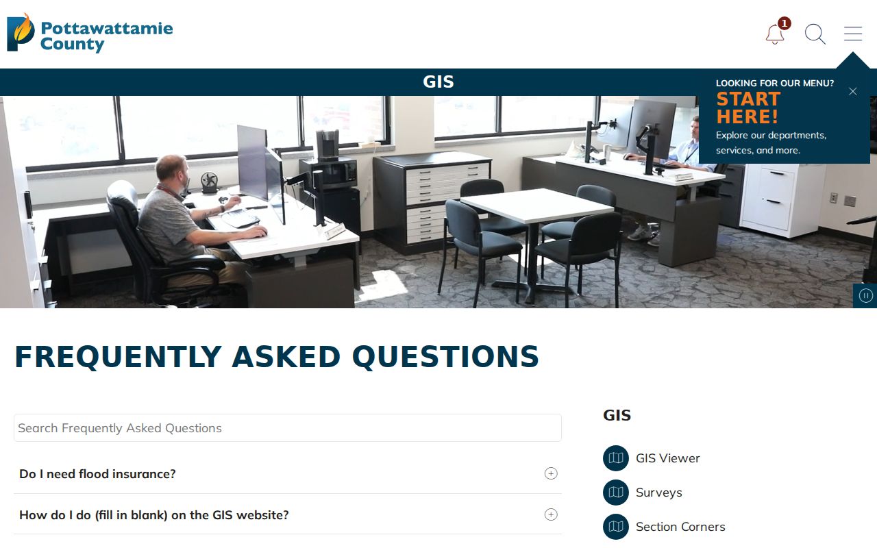
Use GIS for discovery and context. A boundary dispute requires the recorded plat, legal description, and professional survey evidence.
Council Bluffs Address Permit Events
The City Building Department publishes monthly permit reports that add dates to a property trail. The June 2025 report includes permit number, issue date, address, owner, contractor, square feet, project type, fee paid, and valuation. One line for 3331 Avenue A records a June 11 reroof permit. That line proves a permit event, not that the named owner or contractor lived there.
When the report series does not cover the needed date, request records for a specified address and time range through the city. Code-enforcement complaints lack a public result index in the inspected sources, so those also require a focused request. Keep every response tied to its date and agency.
Note: A permit can date a building change, but it cannot supply a complete street directory of occupants.
Council Bluffs Street Boundary Checks
Postal ZIPs 51501, 51502, and 51503 serve Council Bluffs addresses, yet 51503 also appears on rural county locations. Test a disputed address through USPS, the city address layer’s InCity field, county municipal-boundary layers, the assessor’s situs field, and the deed legal description. The 2012 annexation of 10410 Bunge Avenue is a concrete example of a parcel’s municipal status changing while its address trail continues.
No complete official street-renaming or renumbering chronology was located. For an old address, compare the directory year, Sanborn map, plat, legal description, and deed rather than forcing a similar modern street name. Earlier place references may also use Kanesville or Miller’s Hollow, especially before the Council Bluffs name was adopted in 1853.
Voters Along Council Bluffs Streets
The Iowa voter registration search requires a known first name, last name, and ZIP. It confirms a matched voter’s polling route, not every person at an address. A complete voter file follows a separate formal request with jurisdiction, status, party, participation, purpose, payment, preparation time, and statutory use limits.
Voter data excludes people who are not registered, children, guests, ballot choices, and protected records. Iowa Safe at Home can shield qualifying addresses. Never treat the absence of a voter match as proof that no one lives at a Council Bluffs address.
Council Bluffs Streets in Print
For an earlier point in time, the Council Bluffs Public Library advertises city directories dating to 1866, while the Pottawattamie County Genealogical Society lists directories from 1866 through 1994, plus 1996 and 1997. PCGS also holds Council Bluffs telephone books from 1997 through 2016 and a 2020 volume. These are year-specific reference sources, not current household rolls.
Use a street or criss-cross section to turn an old address into a listed name. Then check the resident-name or business section for spelling and context. A line may represent a resident, owner, business, or stale listing, depending on the volume. Record the title, year, page, printed address, and abbreviation key. The library’s digitized archive covers many years only through 1979 and has gaps, so the Iowa Room, PCGS shelf, microfilm, appointment help, and email research route remain important access channels.
Historical listings work best when paired with a deed, census image, obituary, or dated permit. Agreement across independent sources supports the match. Silence in one missing or damaged volume does not show that a household moved.
Council Bluffs Street Directory Limits
A street directory cannot establish current occupancy on its own. Assessor and Recorder records identify tax owners and recorded parties. They omit many occupants. Voter data omits unregistered people and protected voters, while a historical directory shows only what was printed for its year. Driver address data is restricted, and no public utility-customer list was located.
Commercial people-finder data often copies stale or blended records. Official sources are narrower, but each has a named keeper, field definitions, and a correction or copy route. Confirm a material fact with the custodian and note the record date.
Lawful use. Council Bluffs address records are for lawful personal research. Never use a street search to stalk, harass, threaten, or harm anyone.