
Council Bluffs Previous Resident Sources
Choose the source by the year under study. Current assessor cards lead to modern owners, while the Recorder and Auditor carry title evidence farther back. City directories and census images add the household layer. Maps, newspapers, cemeteries, and probate files provide context or an endpoint, but no single record should be treated as a complete answer.
| Source | Years It Covers | Where Held | What It Shows |
|---|---|---|---|
| Recorder deed indexes | 1853–1989 scans; later AVA route | County Recorder and online portals | Recorded parties, book/page, instrument trail |
| Auditor Change of Titles | 1918–1983 | County Auditor online scans and office | Tax-title and transfer changes by name/year |
| City directories | 1866–1979 digitized with gaps | Public Library Digital Archive | Dated resident, business, and street clues |
| PCGS directories and phones | Directories 1866–1997; phones 1997–2016, 2020 | Frontier Heritage Library | Address-to-listing and telephone clues |
| Federal and state census | Federal public through 1950; local state runs vary | NARA, library, and PCGS | Households, relationships, street or district context |
| Sanborn maps | 1885 and 1896 local sets | Library of Congress | Block, footprint, construction, and use context |
Start from today when the building still exists and its parcel can be identified. For a pre-modern address, begin with the closest dated directory or map, then prove continuity through lot, block, plat, and legal description. A missing year is a collection gap until another source shows otherwise.
Date Council Bluffs Past Residents
A previous residents search needs a target year before it needs a name. The library’s digitized directory run starts in 1866 but contains gaps, and PCGS advertises a broader shelf through 1997. Directory inclusion rules differ by publisher and era. Telephone books, resident-name sections, business lists, and reverse street sections are not interchangeable.
Write down the publication title, year, page or image, address as printed, and any abbreviation that affects the match. If the next available volume omits a person, mark the result unresolved until deeds, census material, obituaries, or another directory explain the change.
Council Bluffs Deed Books Online
The Pottawattamie historical Index Books cover 1853 through 1989 through overlapping land, lot, and miscellaneous books. Browse by year, category, transaction surname letter, and both grantor and grantee roles. The earliest visible lots-and-lands grantee run covers 1853–1856 and contains 212 scanned pages with PNG and PDF downloads.
The historical book browser provides the first visual access point for Council Bluffs previous residents research.
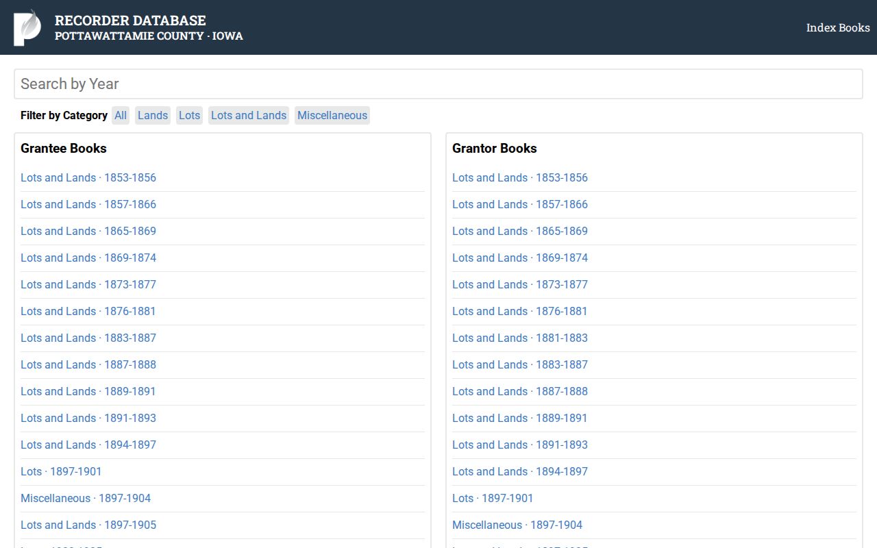
The site is an image index, not a typed database. Read the handwriting, capture the scanned page, and use the book/page clue to request the instrument if needed.
Trace Pottawattamie County Owners
Start with the current tax owner at the Pottawattamie County Assessor. Save the PIN, permanent address, legal or tax description, sales line, and any deed book/page link. Then use the Recorder’s AVA route for post-1989 material and the historical Index Books for earlier entries. Search both party roles because a prior owner may be the seller in one instrument and the buyer in an older one.
- Open the current assessor card and record the owner, PIN, legal description, and sales or deed clues.
- Find that owner’s purchase instrument in AVA or the appropriate historical index run.
- Read the seller, recording date, instrument type, book, page, and legal description from the actual record.
- Search that seller as a grantee to locate the prior purchase, then repeat while the parcel description remains consistent.
- Use office originals, the digital-copy request, Auditor transfer books, or State Historical Society holdings when the web trail stops.
- Grantor / grantee
- The grantor transfers an interest; the grantee receives it.
- Chain of title
- The ordered series of recorded transfers affecting the same land.
- Legal description
- The lot, block, subdivision, PLSS, or metes-and-bounds identity that can remain stable when an address changes.
The Recorder can help locate documents but does not perform a complete title search or give legal advice. For a formal ownership conclusion, obtain the needed copies and use qualified title help.
Read Council Bluffs Index Scans
The 1853–1856 lots-and-lands grantee book demonstrates the repeatable search. Select a surname letter, move through the numbered pages, enlarge or download the scan, and transcribe the relevant line exactly. The book page itself does not expose a reliable typed row, so uncertain handwriting should remain marked uncertain.
The captured scan page shows why image review matters for early previous residents research.
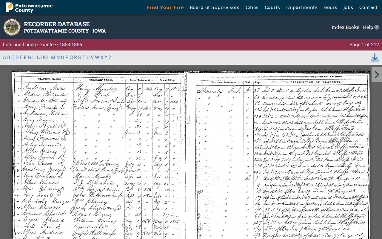
Carry the written name, date, property clue, book, and page into the next search rather than relying on a browser transcription.
Council Bluffs Title Change Bridge
The Pottawattamie County Auditor receives Recorder transfers, proofs them, researches the chain, and enters them in Transfer Records for taxation. Digitized Change of Titles pages span 1918 through 1983 and can be browsed by year and name. They are useful when an index entry is hard to read or a direct deed image has not yet been found.
Older county series also appear in the State Historical Society inventory, including transfers, deed indexes, probate, naturalization, census, vital records, and early plats. This is a collection guide, not a live name search. Ask the archive or custodian about viewing and copies after identifying the series and date span.
Map Old Council Bluffs Buildings
The Library of Congress holds Council Bluffs 1885 Sanborn maps in ten sheets and an 1896 set in forty-six sheets. These fire-insurance maps can date a building footprint, street alignment, lot context, construction material, or use. They do not name everyone who lived inside.
Pair a Sanborn sheet with the closest city directory and the deed’s legal description. This three-source check is especially useful when the current parcel shape differs or a street label has changed. No complete official Council Bluffs renumbering chronology was found, so similar numbers alone are weak proof.
Earlier Council Bluffs Place Names
Pre-1853 searches may require Kanesville, Miller’s Hollow, or Hart’s Bluff as place terms. Pottawattamie County was established in 1847 and organized in 1848, and Council Bluffs became the county seat. The modern city name was adopted in January 1853. Later railroad growth from 1867 changed the city’s scale and street context.
Search the old and modern names together, but anchor the address to a plat, lot, block, or legal description before declaring continuity. The Council Bluffs Bugle and early directories add names and events, while county land and court series supply the record identity.
Council Bluffs Historical Research Desks
The Council Bluffs Public Library Iowa Room supplies local books, microfilm, census and cemetery sources, newspapers, obituary help, maps, photographs, yearbooks, and digitized special collections. Some Special Collections work needs an appointment. Reference help is listed on weekdays, and the research appointment number is (712) 890-5431.
The Pottawattamie County Genealogical Society’s Frontier Heritage Library at 622 South Fourth Street adds broad city-directory, phone-book, census, obituary, atlas, map, legal-file, and surname holdings. It advertises Tuesday hours or appointments and accepts email research requests, though no current request fee was found in the official material. These in-person and staff-assisted routes matter when a scan is absent, handwriting is unclear, or the needed year falls in a digital gap.
Ask a focused question. Supply the address as printed, likely year range, surnames already found, lot or block when known, and citations to the scans checked. That gives staff a reproducible starting point and keeps a probable match from becoming an unsupported claim.
Council Bluffs Past Household Trail
Owners are only one part of the address history. Use the closest available street or criss-cross directory to find a dated listing, then confirm the same person in the resident-name section. Move to the next available volume rather than assuming annual publication. The holdings and year runs are detailed on the Council Bluffs city directory page.
- Normalize the printed direction, suffix, unit, and old city name while preserving the original text.
- Find the address in a street or reverse section, then check the surname in the resident or business section.
- Compare the nearest federal or state census year and verify the image, street, and enumeration district.
- Use newspapers, obituaries, cemetery transcripts, probate, marriage, and deeds to test a departure, death, or family link.
- Label the result exact, probable, or unresolved, with every year and page cited.
NARA’s federal census images are public through 1950 under the 72-year release rule, and OCR should always be checked against the page. PCGS lists local state-census holdings, while the library offers obituary help, newspaper access, cemetery material, and genealogy collections. Probate files may identify heirs, yet access and protected details still depend on the court or archive.
Lawful use. Research Council Bluffs previous residents for house history, genealogy, estates, or personal curiosity. Never use these records to track, harass, threaten, or harm a living person.
Protect Council Bluffs Property Names
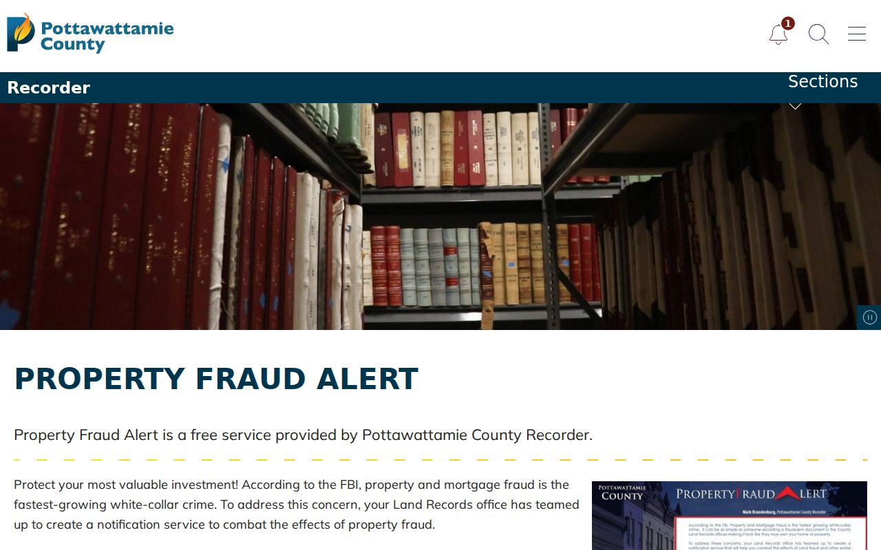
The Recorder’s free Property Fraud Alert sends notice when a recording matches an enrolled name. It does not block a filing or prove fraud, but it gives an owner a prompt to inspect the record and contact the proper office. A separate notary alert began in 2025.
The official alert page appears in this Council Bluffs previous residents capture.
Keep alerts separate from historical conclusions. They are current safeguards around new recordings, not evidence that a past owner or resident was involved in wrongdoing.